We See Changes So You Can Act
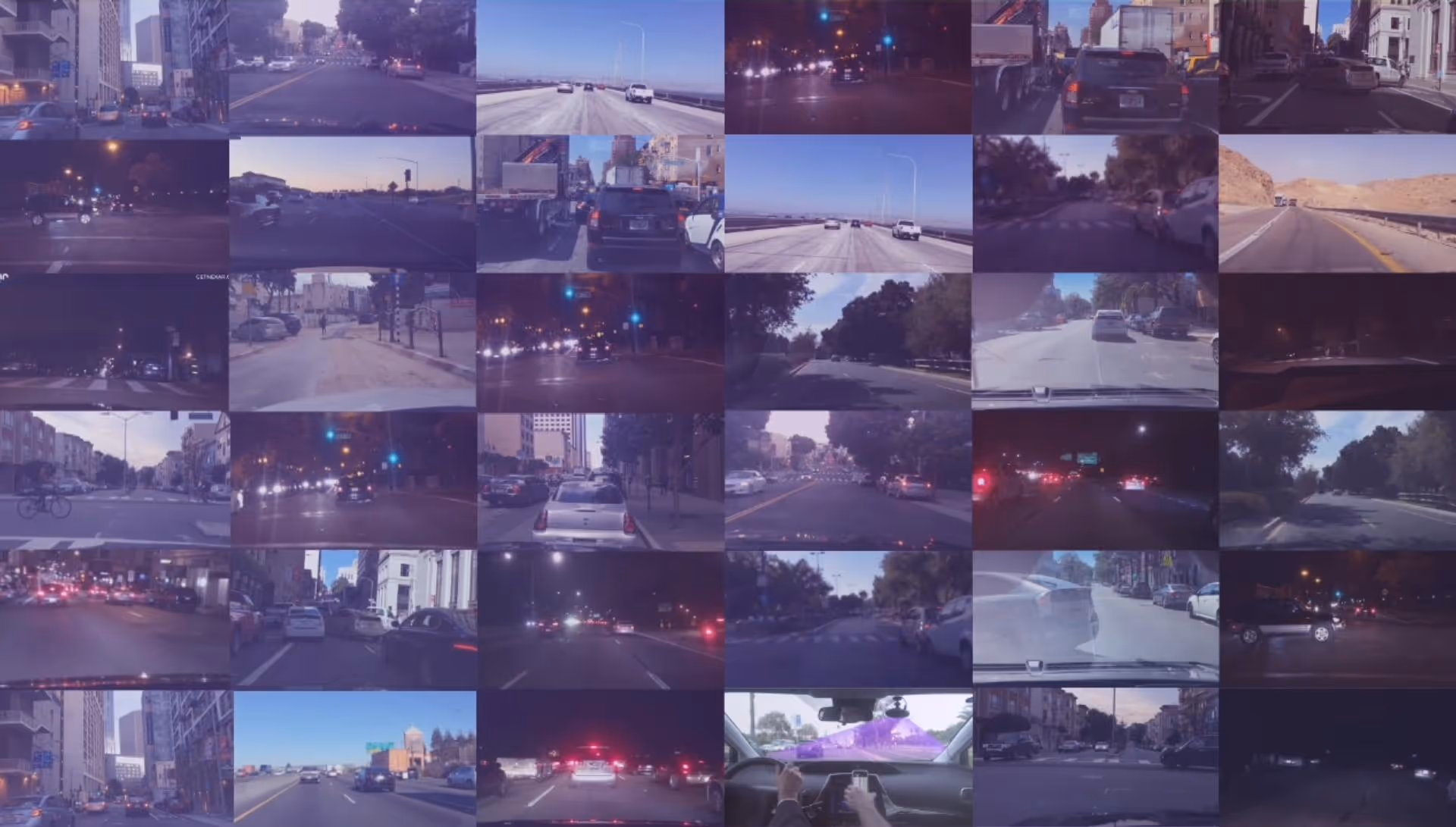
Fresh images and AI detections from a crowd-sourced vision network, for a digital twin of roads and cities.
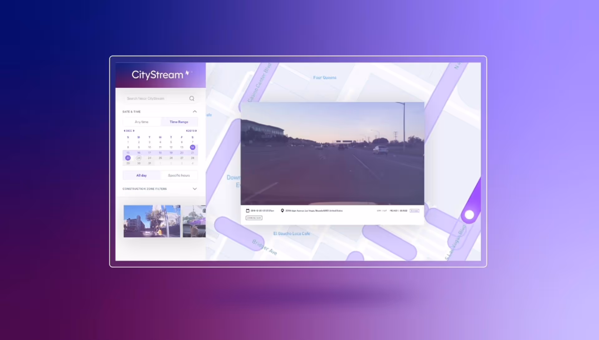
CityStream®
CityStream®CityStream uses trillions of images received from the Nexar dash cam network to produce insights that help you make better decisions. Using artificial intelligence, CityStream analyzes frames and gets you actionable data from the physical world so you can make better decisions.
Introducing crowd‑sourced vision
Dash cams collect images
Nexar dash cam users anonymously contribute images from their drives
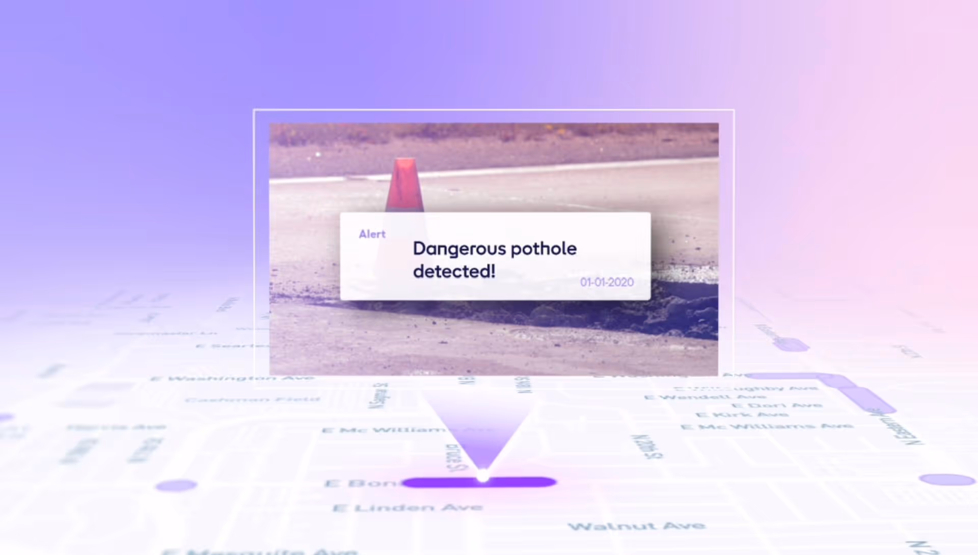
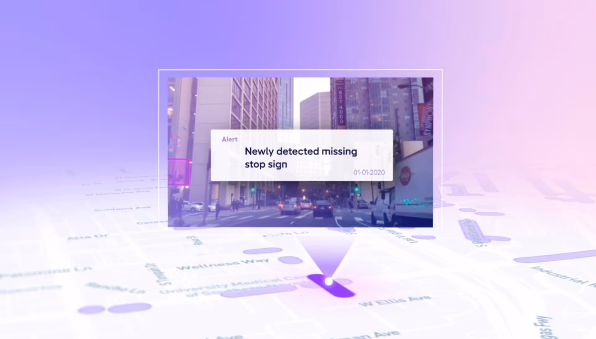
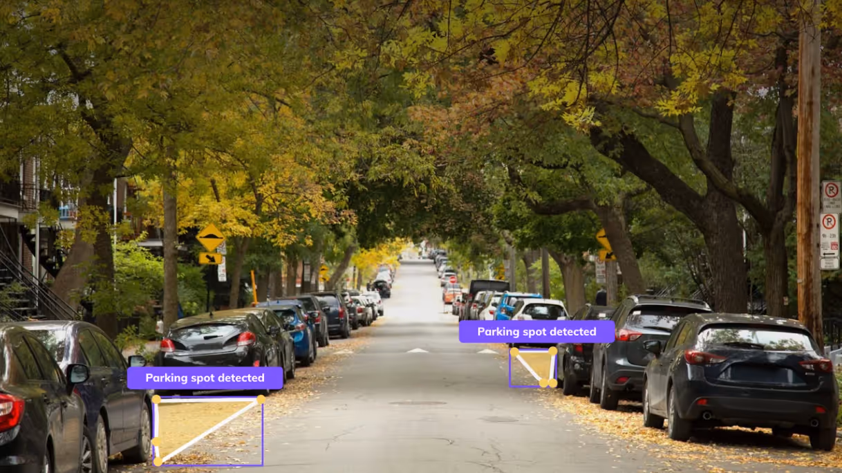
AI detects CityStream road inventory
Nexar uses cutting edge Artificial Intelligence on the dash cams and app to detect road assets
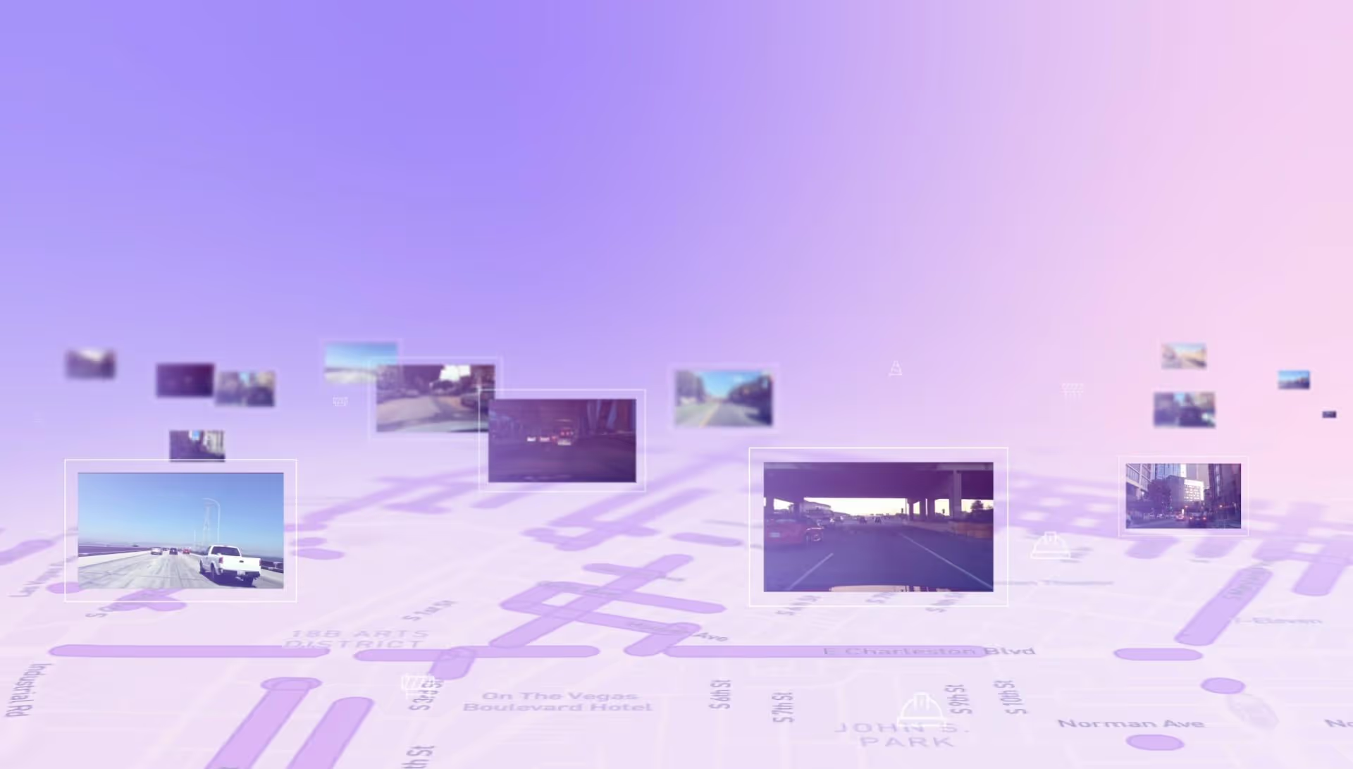
Detections on map
These detections are aggregated, localised and put on a map, making monitoring of changes easy
Fresh Data, Better Decisions
Nexar’s network of connected vehicles provides trillions of fresh, ground-level images and creates the largest road vision data inventory. You can see road signs and construction zones in the correct location as well as see any changes to them, in context.
Using Vision for Safety
Changes in signs, road furniture and traffic happen on a daily basis, affecting the safety of drivers and pedestrians. Nexar enables cities and DoTs to improve safety on the road through a visual record of the road as well as AI detections.
Our Coverage
1.5B
Total DrivenMiles
200M
Total Milesper Month
4T
Images in Neural Library
Work Zones
With CityStream Road Work Zones you can detect, monitor, and map all road work zones in your area of interest. Nexar automatically detects barricade elements in work zones using Artificial Intelligence. Recent images of these barricade elements are then aggregated, localized and mapped into CityStream Road Work Zones so you can remotely manage them and be WZDx ready.
Road Asset Inventory
Nexar detects road inventory - traffic signs and other furniture - localizes and places it on a map, giving you a fresh understanding of inventory instead of a once-a-year drive through. You can access the underlying images to see for yourself. Nexar also “sees” change, notifying you when road inventory changed, so you can see whether there is a safety or maintenance issue you need to tend to and act upon, Identify damaged, missing, or other changes in road signs, remotely.
Virtual Camera
With Virtual Camera you can explore the physical world with the most up‑to‑date ground‑level imagery in existence. Frames from the Nexar network are made accessible on a map so that you can easily pick any location of interest and place a “virtual camera” around it so you can monitor it remotely.

Add Cameras to Your Municipal Fleet
Increase your fleet's safety and collect quality data with Nexar’s dash cams. Access Nexar footage to both protect your drivers and the people in your city, with better coverage.